A commercial harbor is not a marina with a bigger front door. It is a workplace with lanes, blind corners, and vehicles that can take a mile or more to stop. The markers, zones, bridge signals, and radio calls all exist to make that traffic predictable, and that includes you. Once you can read them, a busy port stops feeling hostile and starts feeling like any other road system.
Read the Harbor Before You Enter It
Start with a current harbor chart, not just the small-scale coastal chart. Harbor charts and the Coast Guard's Local Notice to Mariners show the details that matter at close range: channel edges, designated anchorages, cable and pipeline areas where anchoring is prohibited, small-craft fairways, dredging operations, and bridge clearances.
Check the tide, the current, and the vertical clearance of every bridge on your route before you cast off. A span charted at 22 feet carries less water beneath it at high tide than you might assume, and current in a narrow cut can push you sideways faster than you can correct. A flood tide running against a strong wind will make a choppy, confused chop in an inlet, and a tug captain watching you wallow will give you a wider berth than you deserve.
What to Mark on the Chart
- Bridges: clearance, tender radio channel, and posted hours of operation.
- Anchorages, and no-anchor areas such as cable and pipeline crossings.
- Restricted and security zones, including any temporary ones from the latest notice.
- Range markers, ferry crossings, turning basins, and dredge pipeline locations.
- At least one bailout: a marina, a public float, or a quiet cove you can duck into if weather turns.
Channel Markers: Learning the Grammar
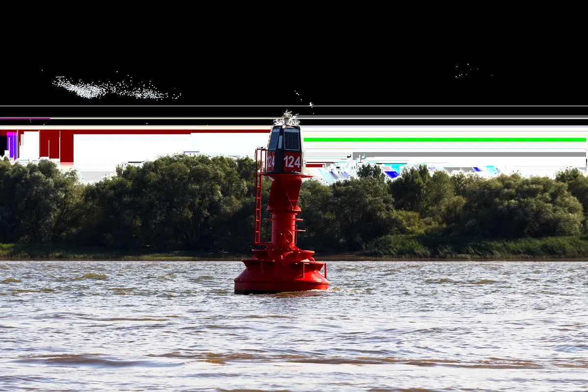
Most United States harbors use the lateral system: in IALA Region B, red marks are kept on the starboard hand when you are returning from sea, and green marks on the port hand. The memory aid is "red right returning." Green buoys are cans and carry odd numbers; red buoys are nuns and carry even numbers. Numbers increase as you head seaward, so a buoy numbered 2 sits closer to open water than one numbered 14. If the numbers stop making sense, you have crossed a junction or turned into a side channel.
Other marks you will meet:
- Safe water marks have red and white vertical stripes and sit mid-channel at a fairway entrance or junction. You pass them on either side.
- Preferred-channel marks carry red and green bands. The top band tells you which color to treat the buoy as, so read it exactly like a mark of that color.
- Range lights are a pair, one nearer and lower, one farther and higher. When they line up vertically, you are on the channel's axis. Drift off and they separate. They are more precise than any buoy.
- Daymarks on pilings mark the same sides as buoys, and their light rhythms matter. A quick-flashing light often flags a turn or junction; a fixed or slow-flashing light usually marks a straight stretch.
Buoys move. Ice, storms, and collisions drag them off station, and ice or high water can sink them entirely. When a buoy disagrees with your chart and with everything else you see, trust the chart and your eyes together, slow down, and feel your way.
Restricted Zones, Security Zones, and Movable Hazards
Working harbors contain areas you cannot enter, and they are not always drawn on a chartplotter that was updated three seasons ago. Expect security zones around cruise terminals, fuel docks, naval vessels and their escorts, liquefied gas facilities, and bridge construction sites. A moving security zone travels with a naval vessel; keep hundreds of yards clear even if nothing is marked.
Dredges and their floating pipelines are the classic local hazard. The pipeline may stretch across part of a channel, may be submerged, and may be moved overnight. Barge fleets, ferry slips, and fish-buying floats all create their own traffic with no regard for your schedule.
If a patrol boat or harbor police directs you, comply immediately and sort out the paperwork later. Read the Local Notice to Mariners before any unfamiliar trip. The notice is free, it is updated weekly, and it is where temporary closures actually appear.
Bridges: Signals, Tenders, and Clearance
A drawbridge is a conversation, not an obstacle. Under the inland rules, a vessel requesting an opening sounds one prolonged blast followed by one short blast. The bridge answers with the same signal if it will open, or with five short and rapid blasts if it cannot. Many modern bridges skip the horns entirely and simply monitor VHF channel 13, answering by radio.
Practically, here is the sequence that works:
- Call the bridge tender on the posted channel at least a half mile out. Give your vessel name, your position, and which direction you are traveling.
- Ask directly: "Can you open for me?" Do not assume an opening is automatic during rush hour, when many bridges are restricted.
- Hold clear of the span and the fender system until you see the span lift and the lights change. Watch the bridge's own signals and the signage on the fender; light arrangements vary, so the tender's radio confirmation is your best source.
- Once open, cross briskly and without stopping. Do not weave around another boat mid-span.
Fixed bridges have their own trap: the clearance board at the waterline reads the actual height, which changes with the tide. Add an antenna or a radar dome and your air draft grows.
Talking on the Radio
Two channels do most of the work in a commercial harbor. Channel 13 is the bridge-to-bridge navigation channel, where tugs, ships, pilots, and tenders coordinate. Channel 16 is for distress, safety, and initial calling. Channel 9 is the informal recreational calling channel in many areas. Keep working chatter on 13 clipped and specific.
A useful call is short and states three things: who you are, where you are, and what you intend to do. "Tug Barbara Ann, this is the sailing vessel Osprey, a half mile north of the bridge, planning to follow you through. Standing by on one-three." Then stand by. Listen. If the tug answers, do what you said you would do.
Never assume a commercial vessel has heard you because you spoke. If you do not get a reply, repeat once, then act as though you were never heard. Silence on the radio is information too.
Sharing the Water With Deep-Draft Traffic
A loaded ship's bridge can be a thousand feet from her bow, and the crew may not see a small boat close aboard. Her stopping distance is measured in miles. The practical rule is simple: do not make a ship do anything. Do not cut in front. Do not pass close alongside, where bank suction can pull you toward the hull. Cross well astern, with clear water on both sides.
Tugs with a long tow handle like a train with a soft coupling; the barge at the end of the wire swings wide on turns. Give them the whole channel, and pass on the side the captain expects. A short, clear radio call settles that question quickly. Keep your wake modest near
Photo: 2857440 / Pixabay